
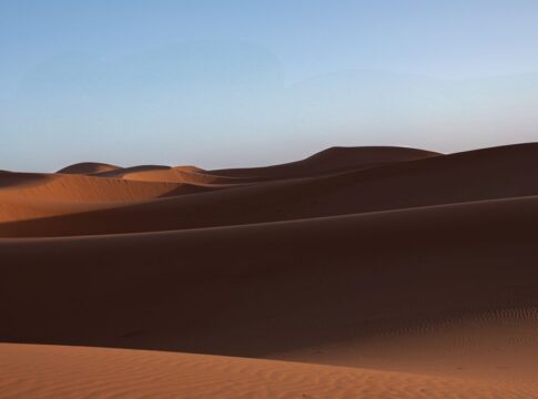
9 Record-Breaking Facts About the Sahara Desert’s Size
By Trivia Daily, Staff Writer — Published September 26, 2026
Table of Contents
- Key Takeaways
- Record-Breaking Sahara: Understanding Its Continental Scale
- Comparing the Sahara to Familiar Places
- The Nine Record-Breaking Facts
- Why the Sahara Matters Beyond Its Size
- Frequently Asked Questions
Stretching across the width of an entire continent, the Sahara Desert dominates North Africa with an almost unimaginable vastness. Most people know it’s big, but few grasp just how staggering its dimensions truly are. These record-breaking Sahara facts reveal a landscape so enormous it defies easy comparison—a place where entire countries disappear into its sandy embrace and where distance takes on new meaning.
Understanding the Sahara’s size means rethinking what we know about deserts, geography, and the sheer scale of Earth’s natural wonders. Let’s explore the amazing trivia that makes this desert one of the planet’s most astonishing features.
Key Takeaways
- The Sahara Desert covers approximately 9 million square kilometers, making it the world’s largest hot desert.
- It spans roughly the same area as the entire United States, including Alaska and Hawaii.
- The desert stretches across eleven different countries in North Africa.
- From east to west, the Sahara measures about 4,800 kilometers—nearly the distance from New York to London.
- Despite its reputation for sand, only about 20-25% of the Sahara is covered in sand dunes.
- The Sahara continues to expand, growing southward into the Sahel region due to climate factors.
Record-Breaking Sahara: Understanding Its Continental Scale
When geographers measure deserts, they classify them by climate and precipitation rather than terrain. The Sahara earns its record as the world’s largest hot desert—a distinction that separates it from cold deserts like Antarctica. Hot deserts receive minimal rainfall while maintaining high temperatures for most of the year, and the Sahara exemplifies both criteria with brutal efficiency.
The desert’s boundaries aren’t fixed lines on a map. They shift gradually through transition zones where desert meets savanna or Mediterranean climate. This dynamic edge means the Sahara’s precise measurements vary slightly depending on the source, but scientists generally agree on the approximate 9 million square kilometer figure. That’s roughly 3.5 million square miles of arid landscape.
What makes this size truly remarkable is its continuous nature. Unlike scattered desert regions, the Sahara forms one massive, interconnected ecosystem. Traveling from the Atlantic coast of Mauritania to the Red Sea coast of Sudan means crossing thousands of kilometers without leaving desert terrain.
Comparing the Sahara to Familiar Places
Numbers alone don’t capture the Sahara’s immensity. Comparing it to familiar territories helps our minds grasp the scale. The desert could swallow entire nations and still have room to spare.
| Region | Approximate Area (sq km) | Comparison to Sahara |
|---|---|---|
| Sahara Desert | 9,000,000 | — |
| United States | 9,834,000 | Slightly larger than Sahara |
| Australia | 7,692,000 | Smaller than Sahara |
| Brazil | 8,516,000 | Slightly smaller than Sahara |
| China | 9,597,000 | Nearly identical to Sahara |
These comparisons reveal something startling: the Sahara rivals the world’s largest countries in total area. It’s not just a desert—it’s a geographic feature on a continental scale.
The Nine Record-Breaking Facts
1. Larger Than Any Single European Country
The Sahara Desert dwarfs every European nation individually and could contain multiple countries simultaneously. All of Western Europe—France, Spain, Germany, Italy, and the United Kingdom combined—would fit comfortably within the Sahara’s borders. This puts the desert’s scale into perspective for those familiar with European geography. The vastness becomes even more impressive when you consider that crossing the Sahara from north to south takes travelers through climate zones equivalent to journeying from the Mediterranean to sub-Saharan Africa.
2. Spans Eleven Different Nations
The Sahara doesn’t respect political boundaries. It stretches across Algeria, Chad, Egypt, Libya, Mali, Mauritania, Morocco, Niger, Sudan, Tunisia, and Western Sahara. Algeria claims the largest portion, with roughly 80% of its territory covered by Saharan landscape. This multinational spread creates complex environmental and political challenges, as desertification and resource management require cooperation across borders. The shared nature of this ecosystem means that climate events in one region can ripple across several countries.
3. East-to-West Distance Rivals Transatlantic Flights
Measuring approximately 4,800 kilometers from the Atlantic Ocean to the Red Sea, the Sahara’s width nearly matches the distance from New York City to London—about 5,600 kilometers. Travelers attempting to cross the desert east to west face a journey comparable to crossing the Atlantic, except on land through one of Earth’s harshest environments. Ancient trade caravans took months to complete such crossings, highlighting both human determination and the desert’s formidable dimensions.
4. Only a Quarter Is Actually Sandy Dunes
Popular imagination pictures the Sahara as endless rolling sand dunes, but this iconic terrain—called erg—covers only about 20-25% of the desert. The remaining landscape consists of gravel plains (called reg or serir), bare rock plateaus (hamada), mountains, and dry valleys. Some regions feature volcanic formations and ancient dried lake beds. This diversity means the Sahara contains multiple distinct ecosystems within its boundaries, each presenting different challenges and supporting different forms of life.
5. Growing Southward Into the Sahel
The Sahara isn’t static. Research indicates the desert has expanded roughly 10% since 1920, pushing southward into the Sahel—a semi-arid transition zone between desert and savanna. This expansion results from both natural climate cycles and human activities like overgrazing and deforestation. The advancing desert threatens agricultural communities and wildlife habitats, making it a pressing concern for environmental scientists and the millions of people living along the Sahara’s southern edge.
6. Contains the World’s Largest Sand Sea
Within the Sahara lies the Rub’ al Khali—wait, that’s actually in Arabia. The Sahara’s largest sand sea is the Grand Erg Oriental in Algeria and Tunisia, covering roughly 600 kilometers from north to south. These massive dune fields contain some of the tallest sand mountains on Earth, with certain dunes reaching heights over 180 meters. The sheer volume of sand in these formations represents millennia of geological processes, as ancient rivers and wind patterns sculpted the landscape.
7. North-South Span Crosses Multiple Climate Zones
From the Mediterranean coast of North Africa to the tropical Sahel, the Sahara stretches approximately 1,800 kilometers north to south. This journey takes travelers through dramatically different environments: from areas receiving occasional winter rainfall to hyper-arid cores that might not see precipitation for years. The climate variation across this distance demonstrates how the desert serves as a transition zone between temperate and tropical regions of Africa.
8. Larger Than the World’s Smallest 50 Countries Combined
If you combined the land area of the world’s 50 smallest countries—from Vatican City to the Maldives to Luxembourg—they would occupy only a tiny fraction of the Sahara’s expanse. This comparison highlights the absurd disparity in how land is distributed across Earth’s surface. Entire nations with millions of inhabitants could fit dozens of times over into a desert where human population density drops to near zero in many regions.
9. Contains Mountain Ranges Over 3,000 Meters High
The Sahara isn’t uniformly flat. The Tibesti Mountains in Chad reach elevations exceeding 3,400 meters, while the Ahaggar Mountains in Algeria rise above 2,900 meters. These ranges create microclimates and support isolated ecosystems dramatically different from the surrounding lowlands. The presence of such topographic diversity within the desert adds vertical dimension to its already staggering horizontal scale, creating a landscape of unexpected complexity.
Why the Sahara Matters Beyond Its Size
The Sahara’s record-breaking dimensions make it a crucial component of Earth’s climate system. Its vast surface reflects solar radiation, influencing atmospheric circulation patterns across the Northern Hemisphere. Dust storms lifting millions of tons of sand travel thousands of kilometers, depositing nutrients in the Amazon rainforest and affecting air quality across the Mediterranean.
The desert also serves as a natural laboratory for studying extreme environments. Understanding how life persists in such harsh conditions informs everything from agricultural drought resistance to the search for life on other planets. NASA and other space agencies study Saharan geology as an analog for Martian terrain.
Frequently Asked Questions
Is the Sahara the largest desert in the world?
The Sahara is the world’s largest hot desert, but Antarctica and the Arctic are larger when cold deserts are included. Antarctica covers about 14 million square kilometers, making it Earth’s largest desert overall based on its extremely low precipitation.
How long would it take to walk across the Sahara Desert?
Walking across the Sahara’s 4,800-kilometer width at an average pace of 25 kilometers per day would theoretically take about 192 days of continuous walking. In reality, extreme heat, lack of water, and difficult terrain make such a journey impossible without extensive support.
Does the Sahara Desert continue to grow?
Yes, studies show the Sahara has expanded approximately 10% since 1920, particularly along its southern boundary. This growth results from natural climate variability, including decades-long rainfall patterns, combined with human activities like deforestation and unsustainable land use.
What percentage of Africa does the Sahara cover?
The Sahara Desert covers roughly 30% of the African continent. Africa’s total area is approximately 30 million square kilometers, and the Sahara’s 9 million square kilometers represents nearly one-third of that landmass, making it the dominant geographic feature of North Africa.
The Sahara’s size challenges our perception of what a desert can be—not just a barren wasteland, but a geographic force shaping continents, climates, and human history. Every grain of sand is part of a system so vast it influences weather patterns half a world away, reminding us that Earth’s largest features operate on scales that humble even our most ambitious constructions.